Interactive Maps
Mount Vernon to Anacostia River
Search Potomac Sites
Also Explore
| The Hudson River Guide | The Delaware River Guide |
| The Connecticut River Guide | |
Potomac River at Point of Rocks
River Monitoring Site
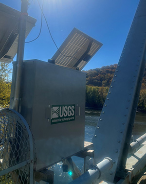
The USGS gage on the Potomac River at Point of Rocks, Maryland, is a long-standing monitoring station that has been recording river conditions since 1895. Located on the left bank at the downstream side of the U.S. Highway 15 bridge, just below the confluence with Catoctin Creek and upstream from the Monocacy River, the gage provides continuous measurements of river stage and flow. It uses a water-stage recorder and crest-stage gage. Over the years, the data from this site have been essential for tracking floods, droughts, and daily river fluctuations, while also reflecting the influence of upstream reservoirs and hydroelectric plants on low-flow conditions. This gage remains a critical tool for hydrologists, emergency managers, and the public, offering real-time information that supports water management, safety, and ecological studies along the river.
Federal and state agencies maintain river level monitors throughout the Potomac River Basin. The U.S.Geological Survey compiles real-time information from river monitors, in cooperation with the U.S. Army Corps of Engineers and the National Oceanic and Atmospheric Administration (NOAA).
NOAA has an on-line river forecast service for the Potomac River at Point of Rocks summarized below.
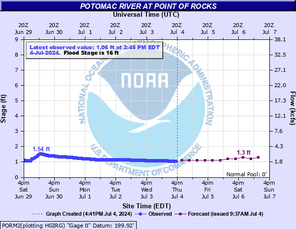
For detailed USGS data on this site, select this link.
Nearby Potomac River Stream Monitors | |
Upstream | Downstream |
To view a map of Potomac River Monitors, select this link. | |
Suggested Links
Contact Information
U.S. Geological Survey
5522 Research Park Drive
Baltimore MD 21228
443-498-5500
Website