Interactive Maps
Mount Vernon to Anacostia River
Search Potomac Sites
Also Explore
| The Hudson River Guide | The Delaware River Guide |
| The Connecticut River Guide | |
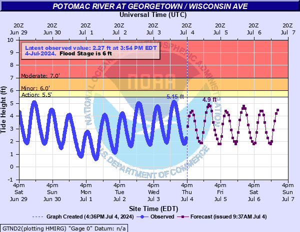
Potomac River at Wisconsin Ave. DC
USGS Streamflow Monitor

The Potomac at Wisconsin Ave. includes a stream gage that monitors flooding potential for some key Washington landmarks.
At 7 feet, (flood stage) NOAA estimates that the river would inundate Washington Harbor, a site that has extensive flood control gates.
At 10 feet, the river would approach K Street in Georgetown.
At 12 feet, the park at the foot of K Street would be flooded. The river levels at this site are affected by tidal action, peaking in high tides twice each day.
Federal and state agencies maintain river level monitors throughout the Potomac River Basin. The U.S.Geological Survey compiles real-time information from river monitors, in cooperation with the U.S. Army Corps of Engineers and the National Oceanic and Atmospheric Administration (NOAA).
Current stream conditions are shown in the graph below:
For detailed USGS information on river flow, select this link.
Nearby Potomac River Stream Monitors | |
Upstream | Downstream |
To view a map of Potomac River Monitors, select this link. | |
Suggested Links
Contact Information
U.S. Geological Survey
5522 Research Park Drive
Baltimore MD 21228
443-498-5500
Website