Interactive Maps
Mount Vernon to Anacostia River
Search Potomac Sites
Also Explore
| The Hudson River Guide | The Delaware River Guide |
| The Connecticut River Guide | |
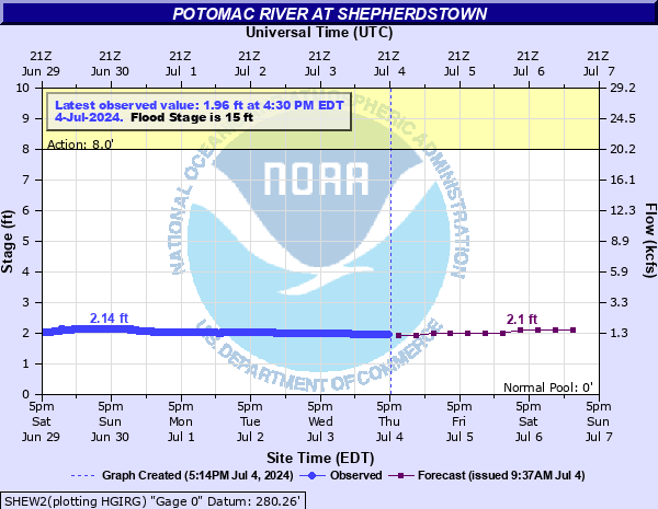
Potomac River at Shepherdstown WV
USGS Streamflow Monitor

The USGS gage on the Potomac River at Shepherdstown is situated near the New Rumsey Bridge across the Potomac . The gage has been in operation for decades and serves as a key reference point for hydrologists, emergency managers, and local communities. Its data are used to track flood events, drought conditions, and daily river fluctuations, offering insight into the health and behavior of the Potomac.
Federal and state agencies maintain river level monitors throughout the Potomac River Basin. The U.S.Geological Survey compiles real-time information from river monitors, in cooperation with the U.S. Army Corps of Engineers.
The National Oceanic and Atmospheric Administration (NOAA) has an on-line river forecast service summarized below.
For real-time data on this site, select this link.
Nearby Potomac River Stream Monitors | |
Upstream | Downstream |
To view a map of Potomac River Monitors, select this link. | |
Suggested Links
Contact Information
U.S. Geological Survey
5522 Research Park Drive
Baltimore MD 21228
443-498-5500
Website