
Connecticut River Guide Interactive Maps
| The Upper Connecticut | Boat Ramps and Kayak Access |
| The Middle Connecticut | Bridges and Ferries |
| The Lower Connecticut | Parks and Historic Sites |
Search Connecticut Sites
Also Explore
| The Delaware River Guide | The Potomac River Guide |
| The Hudson River | |
Windsor Center River Trail
Hiking Trail
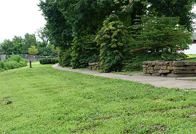
The Windsor Center River Trail is a scenic trail located in Windsor, Connecticut. This 1.25-mile trail, completed in 1996, is situated on a 43-acre wooded preserve along the Farmington River. The eight-foot-wide paved trail provides access to some 2,000 feet of the Farmington River. It’s a great flat and easy trail for walking, running, biking, or any other outdoor activities you enjoy. The trail is also wheelchair-friendly. It’s a popular spot for bird watching, running, and walking. The best times to visit this trail are from February through September. The trail offers beautiful views of the river and is a great place for families. Please note that motorized vehicles and horseback riding are not allowed.
Suggested Links
Contact Information
Town of Windsor
41 Palisado Ave
Windsor, CT 06095
Website