Interactive Maps
Mount Vernon to Anacostia River
Search Potomac Sites
Also Explore
| The Hudson River Guide | The Delaware River Guide |
| The Connecticut River Guide | |
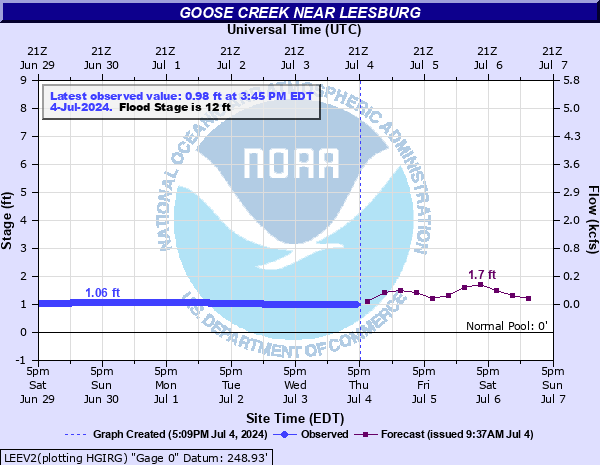
Goose Creek Near Leesburg VA
USGS Streamflow Monitor

The U.S. Geological Survey stream monitoring site on Goose Creek near Leesburg, Virginia has a rich history of hydrologic observation dating back to 1930. Located in Loudoun County, the site was established to support regional water resource planning and flood risk assessment in the rapidly developing northern Virginia area. Over the decades, it has recorded a wide range of streamflow conditions, contributing to long-term datasets used in environmental studies and infrastructure design. The station monitors a drainage area of approximately 332 square miles and sits at an elevation of about 249 feet. Operated in cooperation with the Virginia Department of Environmental Quality, the site remains a vital tool for understanding watershed dynamics and guiding land use decisions in the Goose Creek watershed.
Federal and state agencies maintain river level monitors throughout the Potomac River Basin. The U.S.Geological Survey compiles real-time information from river monitors, in cooperation with the U.S. Army Corps of Engineers.
NOAA has an online chart of flow conditions and forecasts, as shown by the chart below:
For more data on this site, select this link.
![]()
Suggested Links
Contact Information
U.S. Geological Survey
1730 E Parham Rd.
Richmond VA 23228
Website