
Delaware River Guide
Interactive Maps
Upper Delaware
Middle Delaware
Easton to Trenton
NEW! Lower Delaware
Thematic Maps
Boat Ramps
Bridges and Ferries
River Gages
Search Delaware Sites
Also Explore
| The Hudson River Guide | The Potomac River Guide |
I-80 Delaware Water Gap Bridge
Highway Bridge
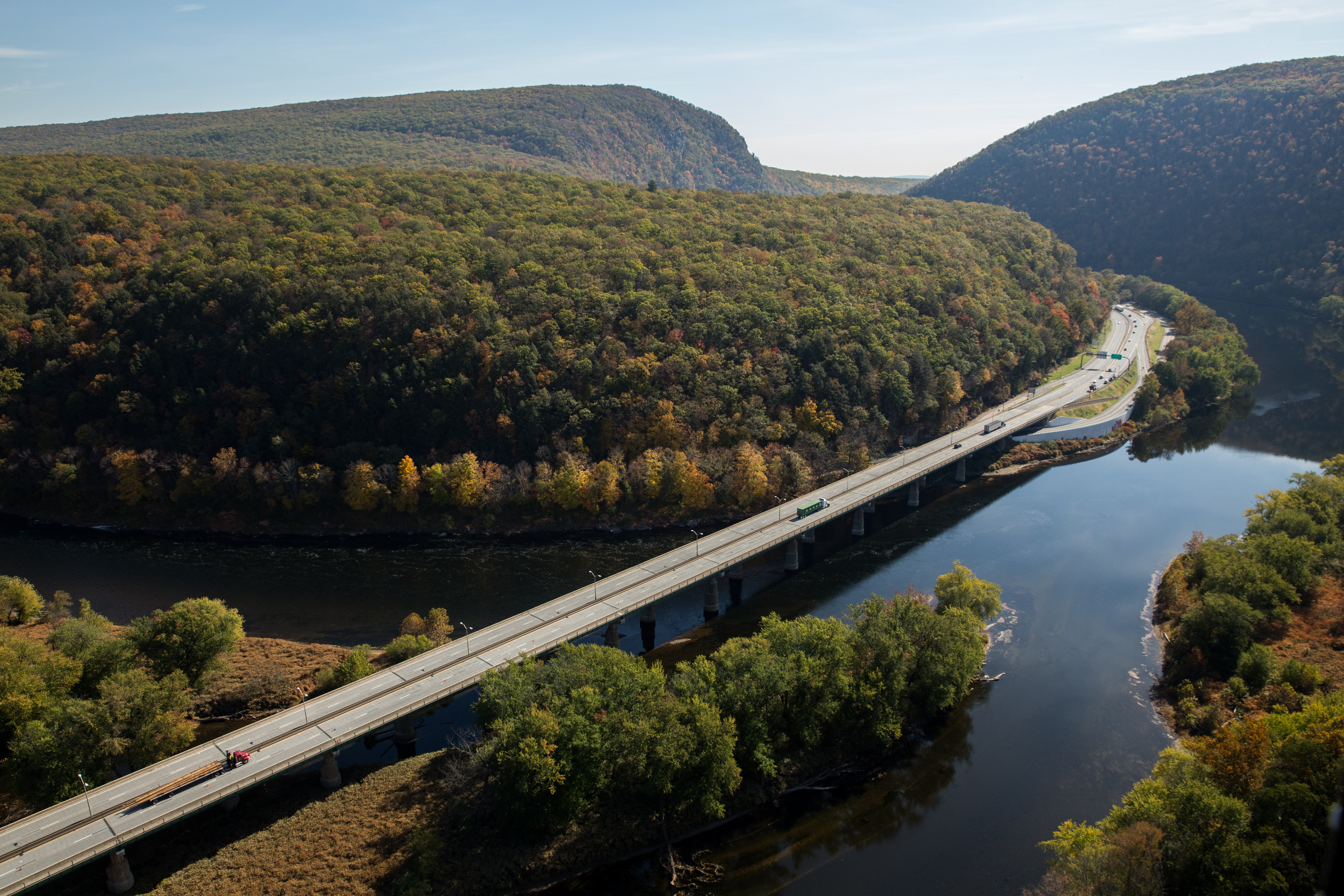
The Delaware Water Gap Toll Bridge (also known as the Interstate 80 Toll Bridge) is a toll bridge that carries Interstate 80 across the Delaware River at the Delaware Water Gap, connecting Hardwick Township, Warren County, New Jersey, and Delaware Water Gap, Monroe County, Pennsylvania, in the United States.The 2,465-foot-long (751 m) bridge is a multiple span dual roadway with a steel plate structure. The roadways are 28 feet (8.5 m) wide each and separated from each other by a concrete Jersey barrier.
The Delaware Water Gap Toll Bridge carries Interstate 80 across the Delaware River near Stroudsburg, Pennsylvania, providing a gateway from eastern metropolitan areas to the Pocono tourist and recreational destinations. Through Pennsylvania, Interstate 80 is a four-lane, limited access highway crossing the entire width of the state to the Ohio border and directly connects to the Ohio Turnpike. On the New Jersey side, Interstate 80 connects the Delaware Water Gap Bridge to the George Washington Bridge. Part of the Appalachian Trail, the bridge offers both hikers and motorists a spectacular scenic view of the world famous Delaware Water Gap. A one-way toll plaza, located on the Pennsylvania approach, has 8 toll lanes. Tolls are collected in the westbound direction. Photo: Delaware River Joint Toll Bridge Commission.
Suggested Links
Contact Information
Delaware River Joint Toll Bridge Commission
1199 Woodside Road
Yardley PA 19067
800-363-0049
Website